JupyterGIS#
JupyterGIS is an in-browser, collaborative Geographical Information System (GIS). It is built on top of Project Jupyter but independently useable. As flagship project of the open GeoJupyter community it aims to enable organizations, researchers, students, anyone interested to easily explore, use and work with geospatial data. We’d love to hear from you at a community meeting!
Note
Backend-free JupyterGIS via JupyterLite runs entirely in the browser and does not support real-time collaboration.
Highlights#
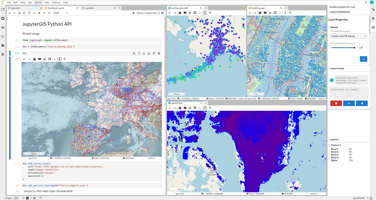
Real-time collaboration — like Google Docs or Miro for GIS, with spatial annotations and comments
QGIS interoperability — import and export QGIS project files
Python API — scriptable workflows in collaborative notebooks
Many data formats — GeoJSON, GeoTIFF/COG, GeoParquet, GeoPackage, Shapefile, PMTiles, WMS/WMTS, and more
Grammar-driven symbology — flexible rule-based styling, similar to Vega-Lite
Storymaps — guided narratives through your maps
Hillshade & heatmaps — terrain and density visualization
GDAL processing — rasterize, warp, and translate directly in the browser or on the server
STAC & OpenEO — cloud-native data catalog and processing support
Pangeo integration — dynamic raster tile serving via TiTiler backed by the Pangeo stack
Identify tool — click features to inspect their properties
Layer gallery — pre-built layer catalog for quick setup
Embeddable — use as a standalone map, an IDE, or from within a notebook
AI skills — integration with Jupyter & JupyterLite-AI. Map operations in natural language
For more details, check out About JupyterGIS.
Documentation